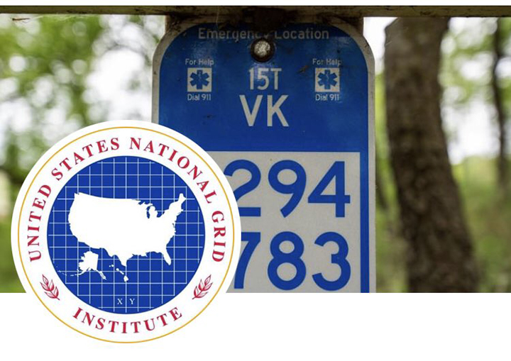
If you’ve been hiking, mountain biking, or skiing in somewhat remote areas, you may have noticed small blue signs along your route. These are U.S. National Grid Emergency Location Markers (ELM).
This US National Grid system offers a way for communities to mark locations such as trail intersections, campsites, buildings, boat landings, and other response locations with a marker that works with GPS, is location specific, unique across jurisdictions, and is nationally consistent. The ELM information also helps responders identify the best access points to reach various locations and what type of vehicle can be used to reach an injured person or persons.
Due to the complex nature of overlapping and interconnecting area ski and bike trails, as well as duplicate or differing names of connecting roads, there has long been a need to implement a system that can aid first responders in reducing response time when there is an injured or lost trail user.
A few years ago the Chequamegon Area Mountain Bike Association (CAMBA), along with other local non-motorized trail groups, began to adopt and implement the ELM signs across the CAMBA trail system as an easy, quick, and definitive way for trail users to identify their location in the event of an emergency.
Hundreds of signs have already been installed in the Namekagon, Cable, and Seeley areas as well as the nearby Lincoln Community Forest and 300 more are expected to be put up on the Hayward area mountain bike trails and the Mt. Ashwabay bike and ski trails near Bayfield, WI.
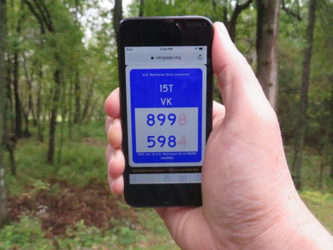
The US Grid System is easy to use and really so important-go to USNGapp.org on your mobile device. Once bookmarked, the site will show your coordinates by satellite as you move-EVEN WITHOUT CELL SERVICE.
You can also use the USNG system via apps, locating you via these apps that you can download onto your phone: either MyUSNG or FineMeSAR for Android users or USNGme for iPhones. Turn on location services on your phone and your coordinates are noted on the grid. The coordinates will change as you move.
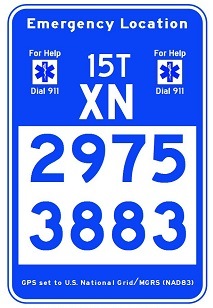
In case of an emergency, dial 911 and give the dispatcher the 8 digits on your app or site, then the nature of your emergency.
If you are going where cell service might be spotty, these apps are still important as they mark a starting point for a search, and again, they are noting your location even without cell service.
In the case of no cell service or if you do not have the app, record or take a photo of the 8-digit number on the closest ELM sign then find cell service to report the emergency.
You can even download a live trail map utilizing the ELM system on Avenza Maps.
Whether you are riding, kayaking, hiking, or even on a road trip, take the time to be safe. A few extra minutes to install the ELM app on your phone can potentially save a life.